")
")
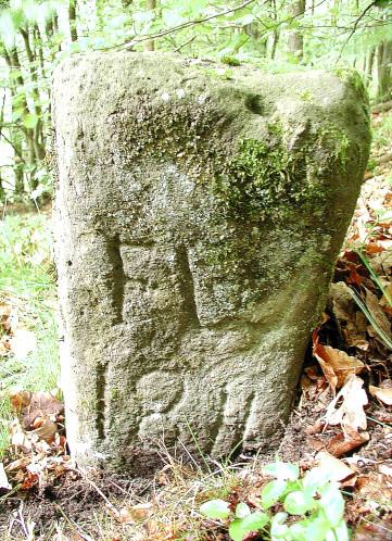
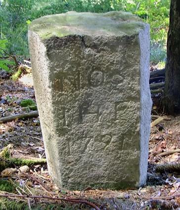
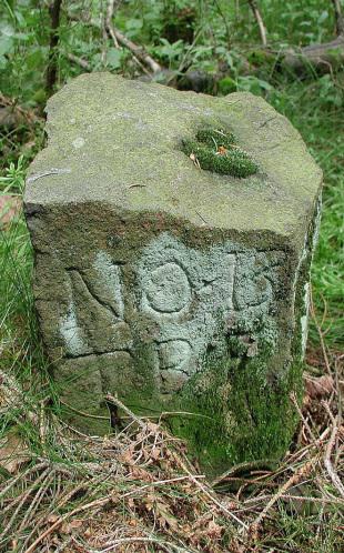
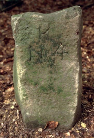
In mining, a Lochstein is a boundary stone marking the property line of a pit. As to the late 19th century, they were set on the surface according to mine surveying and marked the boundaries of the underground mining. They are among the last witnesses of the former mining to be seen above ground. The name Lochstein (hole stone) seems to go back to the medieval word for a boundary stone. These were marked with a notch, which was German ‘Lache’ at that time and therefore called ‘Lachstein’ – a stone with a mark. Each pit owner had the right of an official survey and of setting a Lochstein to mark their mining claim. Once a mine operator had discovered a new deposit, he had to excavate it and then to register the point of discovery. Thus he proved that he claimed his right of mining. The point of discovery was the centre of the new pit. According to Prussian mining laws (1865), the size of the mining area was 3.5 Lachter wide (ancient unit of measure: two arm lengths, about 2m) and 42 Lachter of length. Within this area only the mine operator was allowed mining. The size of mining claims was determined variably in the different mining regions, but the size was defined for each region in specific mining acts. If a mining operator wanted to extend the allowed area, he was entitled to claim additional mine workings.
Unfortunately, most Lochsteine have been destroyed or fell prey to thoughtless collectors.
Hollerter Zug
Dermbach
Fischbacherwerk
Niederfischbach
Bollnbach
Herdorf
Ramberg
Eisern